DJI Terra
Make the World Your Digital Asset
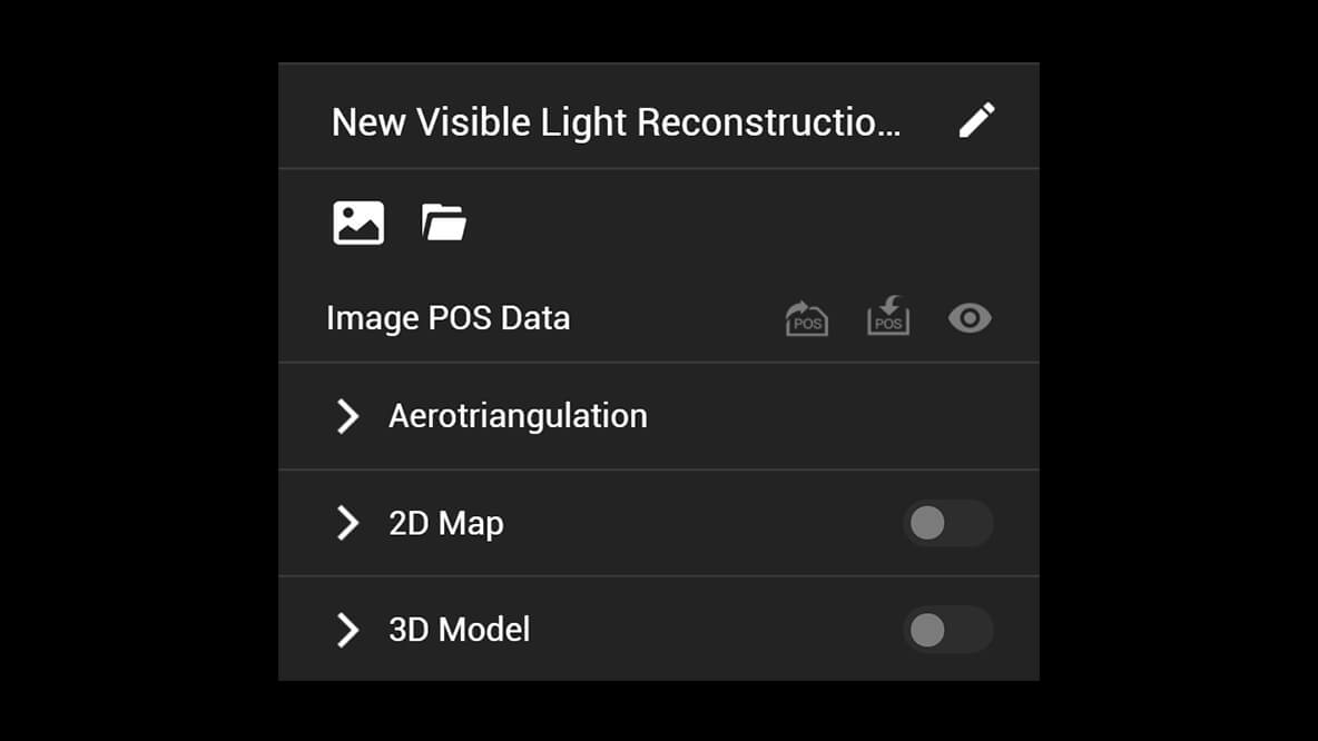
DJI Terra is 3D model reconstruction software that has photogrammetry as its core technology. It supports a range of accurate and efficient 2D and 3D reconstruction of visible light, and data processing through DJI LiDAR. DJI Terra is a perfect match for DJI Enterprise drones and payloads. It works in conjunction to build a complete application solution that caters to verticals such as land surveying and mapping, power transmission, emergency services, construction, transportation, and agriculture.
Area Mapping
3D Models
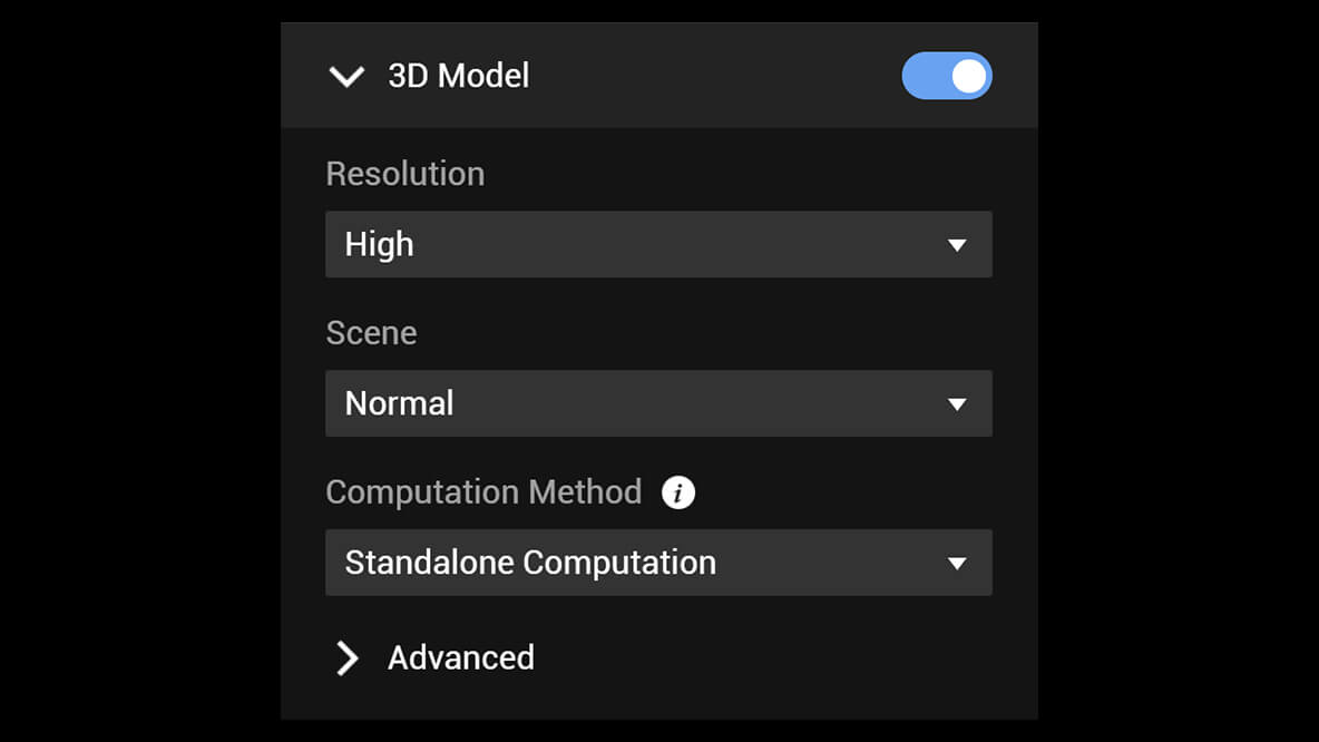
Realistic 3D models can be generated in three resolutions—high, medium and low. Water surfaces in the model are automatically optimized through AI technology, and the formats commonly used in the industry are exported for image reconstruction in diverse scenarios, such as surveying and mapping, accident sites, power grid equipment, and progress-tracking for construction projects.
Scale
- 6,000 photos/1GB (cluster processing)
Efficiency
- 30,000 photos/21 hours (cluster processing)
Accuracy
- Centimeter-level accuracy
2D Maps
The algorithm is optimized according to the different scenarios to significantly improve processing efficiency, effectively avoid image warping and deformation, and obtain detailed and accurate measurement results for all your target objects and survey areas.
Scale
- 6,000 photos/1GB (cluster processing)
Efficiency
- 5,000 photos/80 minutes (cluster processing)
Accuracy
- Centimeter-level accuracy
LiDAR
With just one click, you can perform highly accurate processing of the point cloud data captured by the Zenmuse LiDAR in DJI Terra, including route calculation, precise fusion of point cloud and visible light data, optimization of point cloud accuracy, ground point extraction, DEM generation, and mission report Output.
Multispectral
Using multispectral data from DJI Mavic 3 Multispectral and P4 Multispectral, vegetation index maps including NDVI and NDRE can be produced to provide insight into plant growth and health, radiometric correction is supported and reflectance maps can be generated for remote sensing research. Prescription maps can be created for variable rate application using DJI’s Agras drones to improve crop yields while driving down Costs.
DJI Terra and DJI Modify Seamless Workflow
With one click, DJI Terra can launch DJI Modify. DJI Terra can also easily generate files for model editing with another click. These simple steps make the subsequent model editing process quick and convenient. DJI Modify is DJI’s first intelligent 3D model editing software. It features a streamlined and intuitive interface that is simple to use to complete 3D model editing efficiently. It accurately identifies floating parts, holes, and vehicles in the models. Mesh can be repaired with a single click, with true-to-life textures generated quickly, significantly simplifying the model editing process. Paired with a DJI Enterprise drone and DJI Terra, it forms a comprehensive solution from aerial surveying, modelling, and model editing to sharing these models easily to meet operational needs in surveying and mapping, firefighting, emergency response, and Transportation.
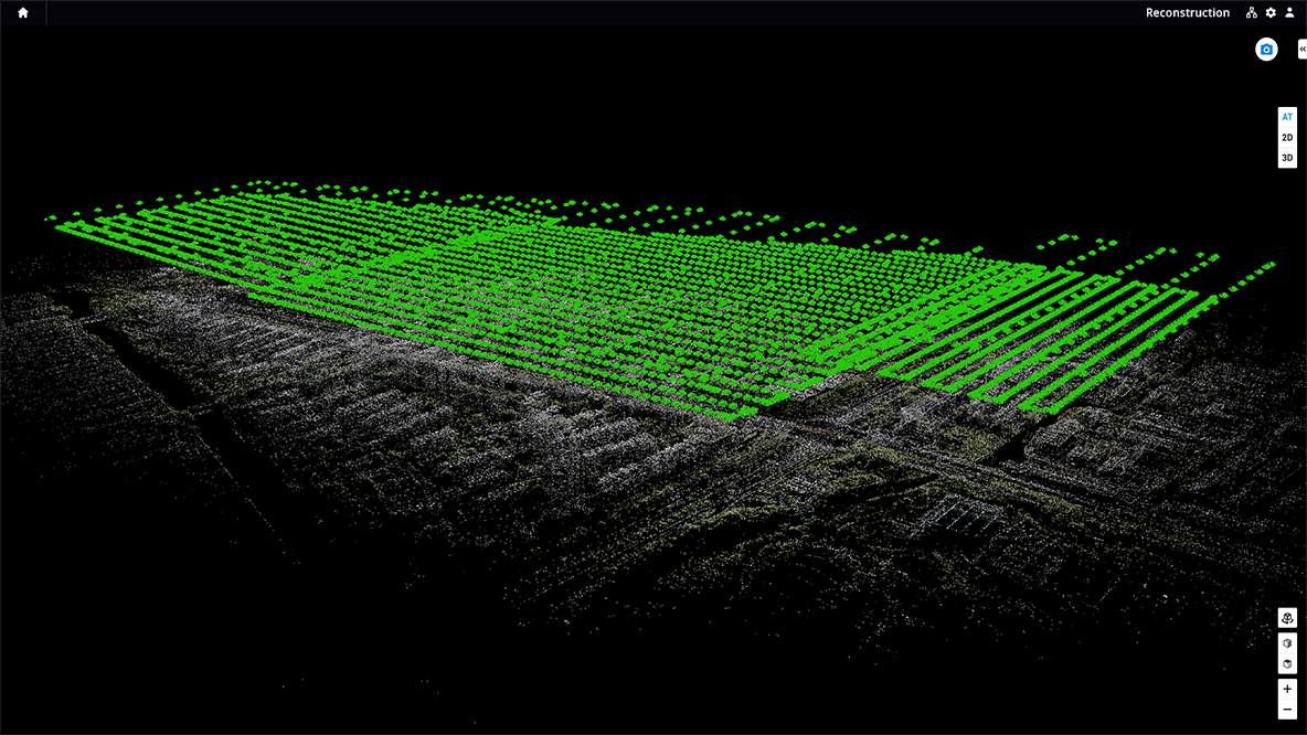
Real-time 3D Mapping
When efficiency is key, quickly render and visualize a 3D model of the mapped area. Make decisions based on the preliminary model and check for completeness immediately or plan 3D flights on-site.
More Highlights
Real-time Mapping
Quickly generate a 2D orthomosaic of the selected area in real-time. Not only is this ideal for creating detailed flight paths in remote areas but it’s also useful for time-sensitive missions that require quick decision-making on site.
Detailed Inspection Mission Planning
Automatically generate waypoints and flight routes based on one or more points selected in a local realistic 3D model or point cloud (or a third-party point cloud). A simulated camera view that includes the selected point is displayed on screen to enable better waypoint selection and more efficient flight route planning, automating inspection workflows.
Seamless Workflows, Accurate Results
Unparalleled efficiency and user experience
A simple and intuitive interface that gets you flying in no time.
Run reconstructions missions by employing multiple graphics Cards simultaneously ti improve Efficiency.
Step 1
Step 2
Step 3
Meet and exceed your project Standards
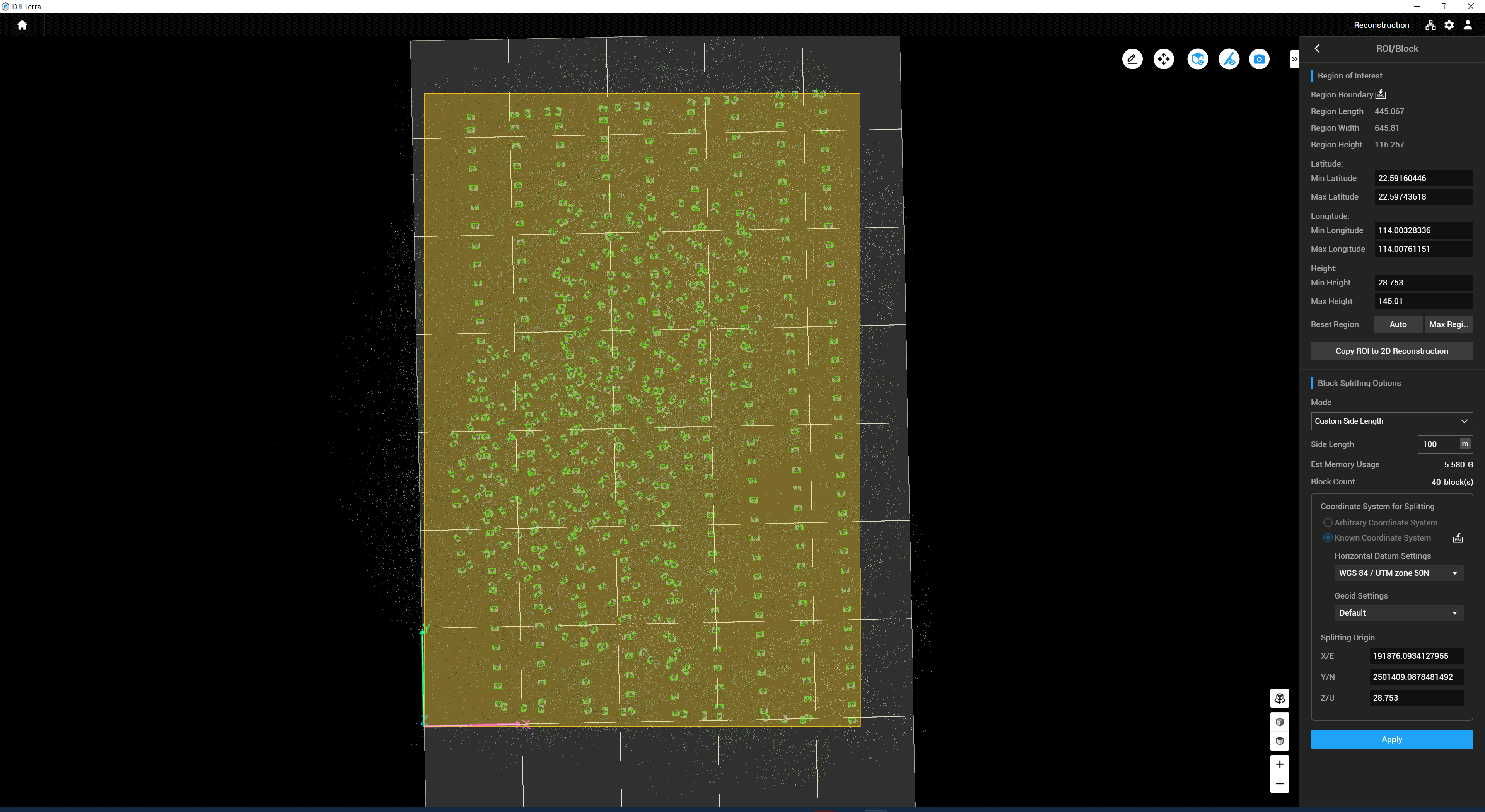
Incorporate POS data, GCPs, or both sets data to create georeferenced maps and models into 8500+ major coordinate systems by simply selscting the output that fits your needs. View a quality report of your mission to ensure the results meet your accuracy standards. Support the auto GCPs für automatic indetification of more photos with marking points by simply marking one photo. With the Region of Interest (ROI) and block, image reconstruction can be performed to specific target region. In turn, this saves processing time and improves efficiency, while generating a clearer model or point cloud, and completing the large-scale block reconstruction and montage.
POS
GCPs
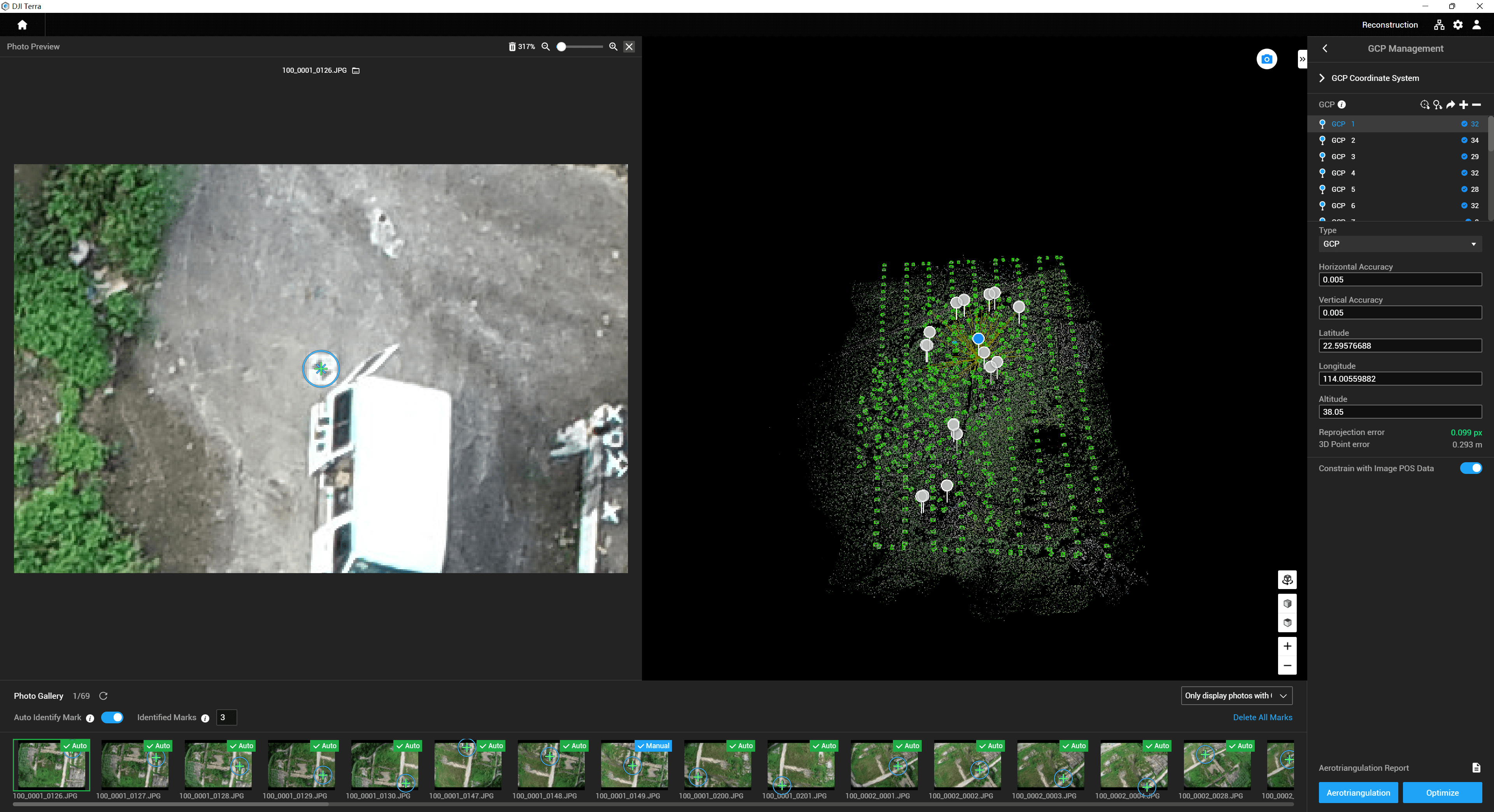
ROI
Intuitive and Effortless
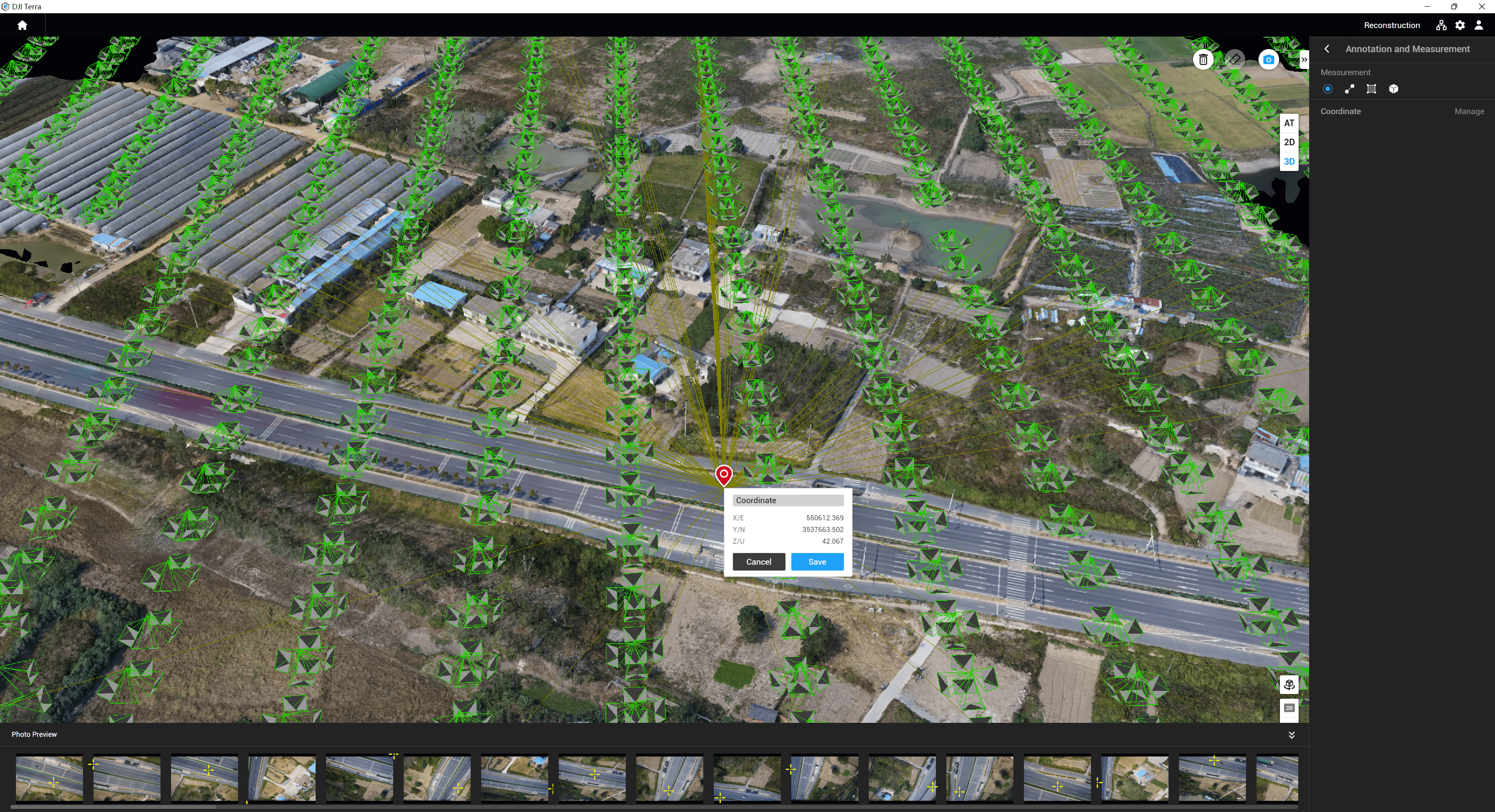
Acquire key dimensions across an array of terrains with easy-to use analysis tools that enable you to obtain a variety of measurement data based on linear, area and volumetric measurements. Edit labels of measurements on existing models, which can be used for reporting and improving communication throughout ongoing projects.
Annotation and Measurement
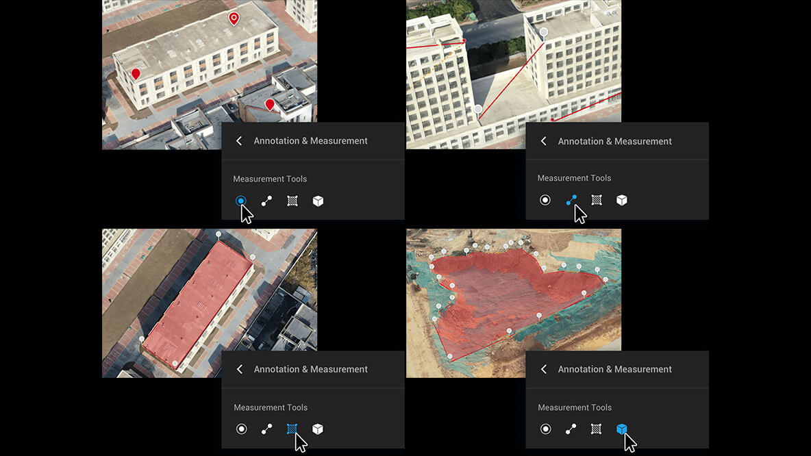
Annotation
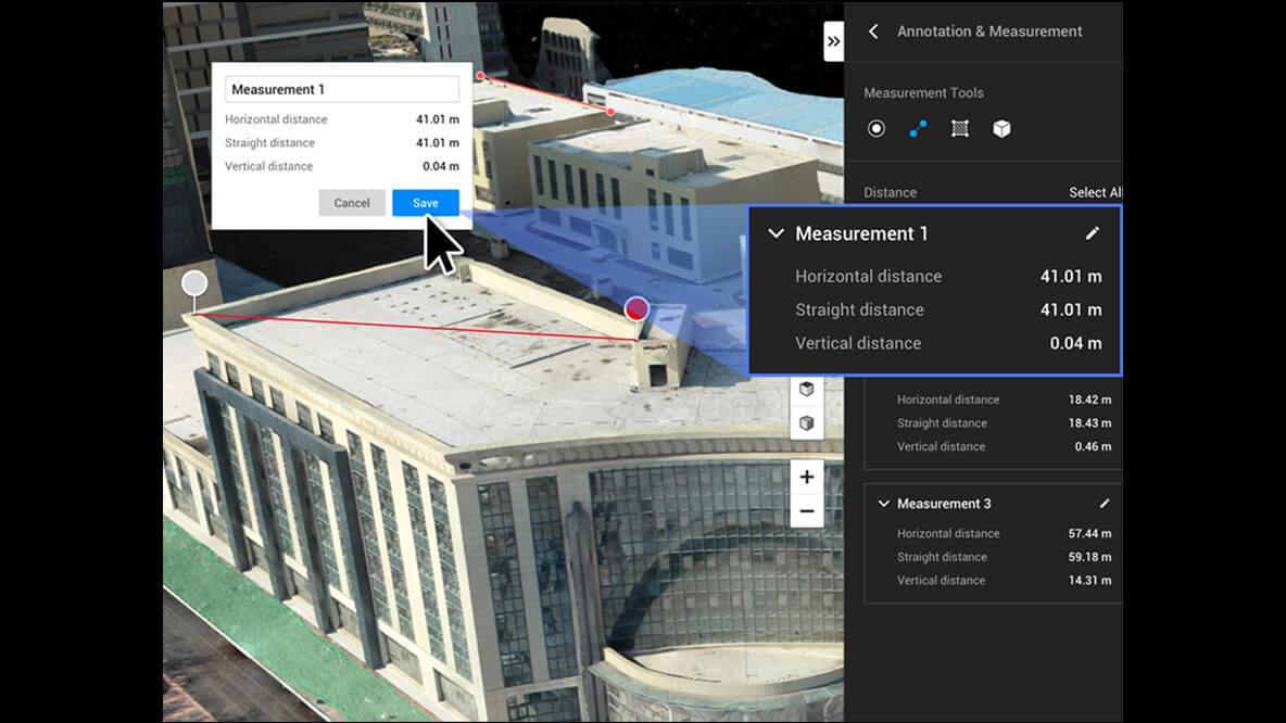
Photo Inspection
Mission Planning
Waypoints Mission Planning
Create efficient flight paths using predefined waypoint actions and adjustable parameters like altitude, speed, gimbal pitch angle, aircraft heading and more. For more complex and tight missions that require high attention to detail, use 3D Flight Visualization to design and simulate tasks on existing 3D models.
Area Mission Planning
With just a few taps on the screen, you can automate complex missions, allowing you to seamlessly capture imagery which can be processed to produce a variety of maps and models for further analysis, and to aid decision-making.
Oblique Mission Planning
When accuracy is essential and details are vital to your critical operations, Oblique lets you capture a rich 3D model data set by adjusting the angle of the camera at a tilted angle, giving you an extra crisp view of the asset.
Corridor Mission Planning
Create automated flight missions around roads and railways by simply drawing a line on the map. Adjust mission settings to change the total area mapped, giving you the flexibility to choose between creating high-definition 2D maps and 3D models or quick overviews.
